Welcome to the Unbuilt Blue Ridge Parkway Digital Exhibit!
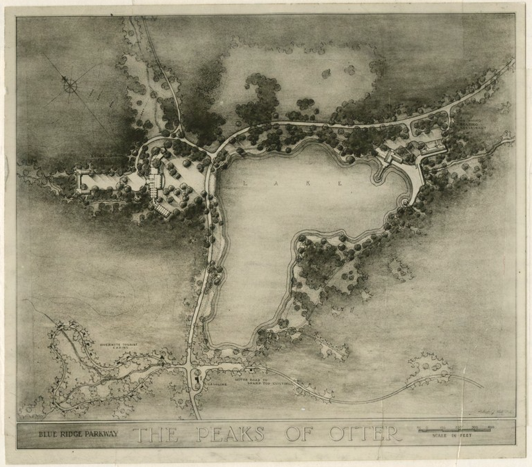
Layout Plans (obsolete), Peaks of Otter, 1956. Plans showing elements of the Peaks of Otter recreation area that were never built, including tourist cabins and a swimming beach.
This interpretive ex hibit is a companion project to Driving Through Time: The Digital Blue Ridge Parkway, a repository of Parkway historical materials hosted at the University of North Carolina Libraries.
The Unbuilt Blue Ridge Parkway exhibit brings together for the first time the stories of several Blue Ridge Parkway-related plans and proposals that were –- for a variety of reasons -– stillborn, killed, abandoned, or changed during the park’s now more than 75 year history.
Taken together, these plans form a shadow Parkway –- the one that might have been. Their stories reveal the breadth and diversity of visions for what the scenic road could be.
These little known episodes remind us that the Parkway we have today was not the inevitable embodiment of a vision clearly seen in full at the outset. Instead, it is the result of real choices made in changing contexts over more than 75 years by real people presented at various points with a number of viable alternatives. This reality asks us to consider: what are our visions for the Parkway’s future? How can we bring those visions to fruition?
Click the links below to explore:
- More information about the project (“Why the Unbuilt Parkway” and “About the Process“).
- Six stories of unbuilt projects (“Unbuilt Projects“)
- Our interactive digital map [no longer working due to discontinuance of the plugin]
- The History 671 class website
- Driving Through Time: The Digital Blue Ridge Parkway
Help us refine the site!
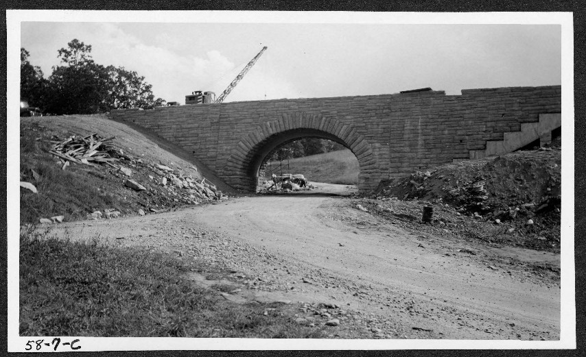
Bridge construction, 1930s, on section 2G of the Blue Ridge Parkway.
This web exhibit is a work in progress. It originated as a class project in Dr. Anne Mitchell Whisnant’s Fall 2013 Introduction to Public History course (History 671) at the University of North Carolina at Chapel Hill. It is a collaborative effort of the 15 students in History 671, the instructor, and colleagues at UNC’s Digital Innovation Lab, managed by Dr. Pam Lach.
Although they have been edited by Dr. Whisnant, a scholar with long expertise on Blue Ridge Parkway history, the stories and map markers presented here are based on one semester’s research by a group of students who knew little about the history of the Blue Ridge Parkway before the course began in August of 2013. The site was completed and initially went live in December of 2013.
The short timetable for research and a rather steep learning curve — combined with the Fall 2013 government shutdown in mid-semester — means that the research presented herein is more suggestive than comprehensive. There may be errors of fact, errors of omission, errors of context. We therefore invite site visitors to offer constructive comments that will help the instructor and future students to improve the site. At the right edge of many pages, you will see a “Feedback” popup that will allow you to send us your comments.
Sitewide Image Credits (Background and Header Images)
Sitewide background: Logical Route for the Southern Portion of the Appalachian Park-to-Park, Highway, 1934, Image depicting the unbuilt “Tennessee Route” for the Parkway. (Image hosted on Driving Through Time, Courtesy Great Smoky Mountains National Park.)
Sitewide header: Sky-Top Drive on the Beautiful Blue Ridge Parkway, Poscard published by the Asheville Post Card Co., Asheville, NC, ca. 1930s/40s. (Image hosted on North Carolina Postcards site, UNC-Chapel Hill Libraries.)